Understand the conditions
Soil profile, texture, pH and organic matter by depth.

Meteon · Soil, water and weather
Soil profiles, water reserves, irrigation zones and hourly forecasts. Your field data in one clear workspace, alongside the map.
Currently free. Try it without an account.
Four views · One field
Move from Overview to soil analysis, irrigation or weather. Switch views while keeping the same field in focus on the map.
Soil profile, texture, pH and organic matter by depth.
Water reserves, rainfall and estimated application rates alongside the map.
Hourly forecasts, frost indications and spraying conditions.
Switch between the four main views. Open any screenshot for a closer look.
Weather, crop condition and root-zone water in one place. Charts sit right alongside your field map.
Screenshots of the app on a sample field in Tolna, Hungary. Model values refer to the date of the captured dataset.Enlarge screenshot
For your daily work
Soil conditions, irrigation and the coming weather are connected. Move between them without losing sight of your field.
From sand, silt and clay proportions to pH: key soil properties in clear charts, organised by depth.
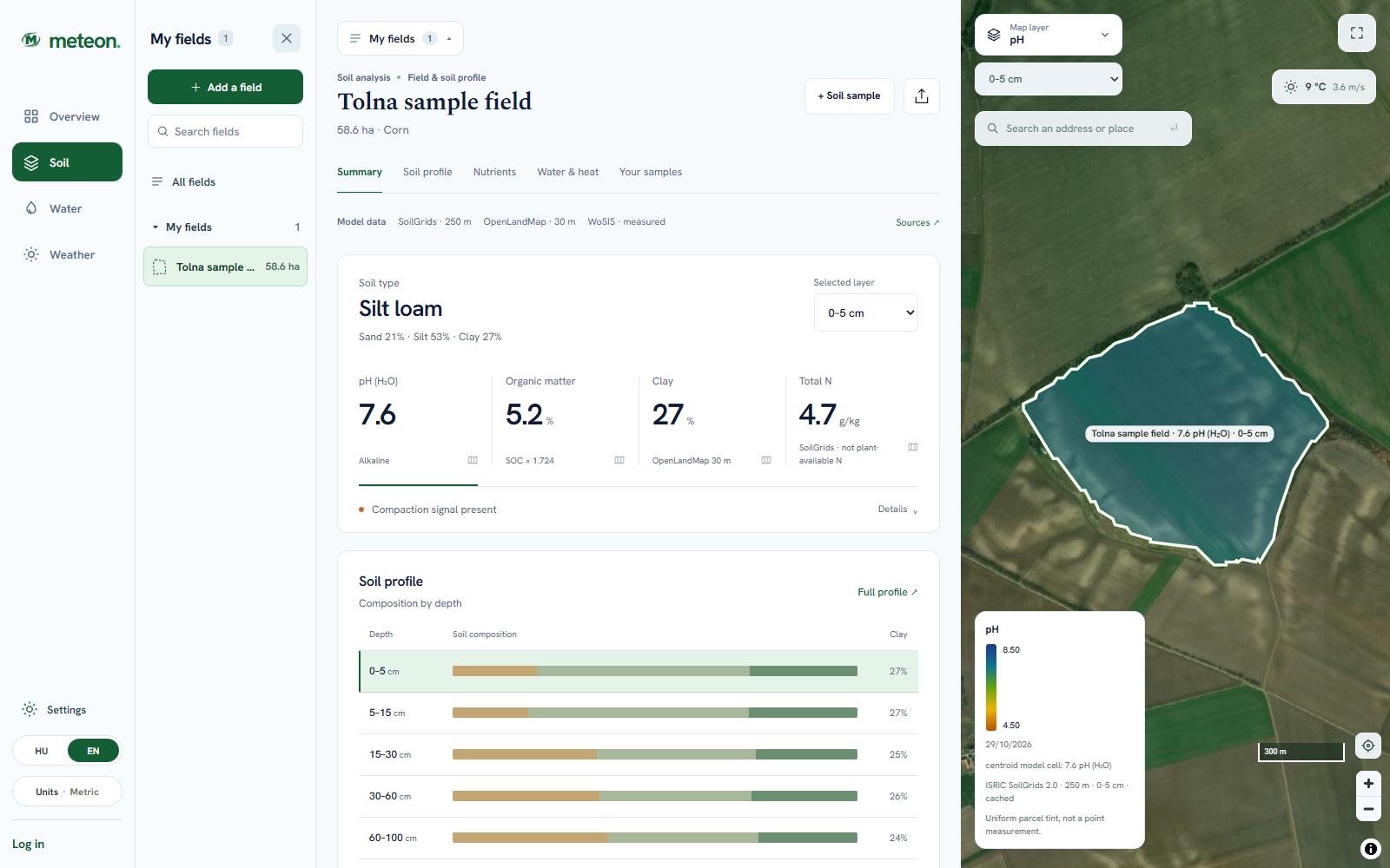 Enlarge screenshot
Water deficit and suggested application are different values. Follow rainfall, crop demand and previous irrigation alongside the water balance.
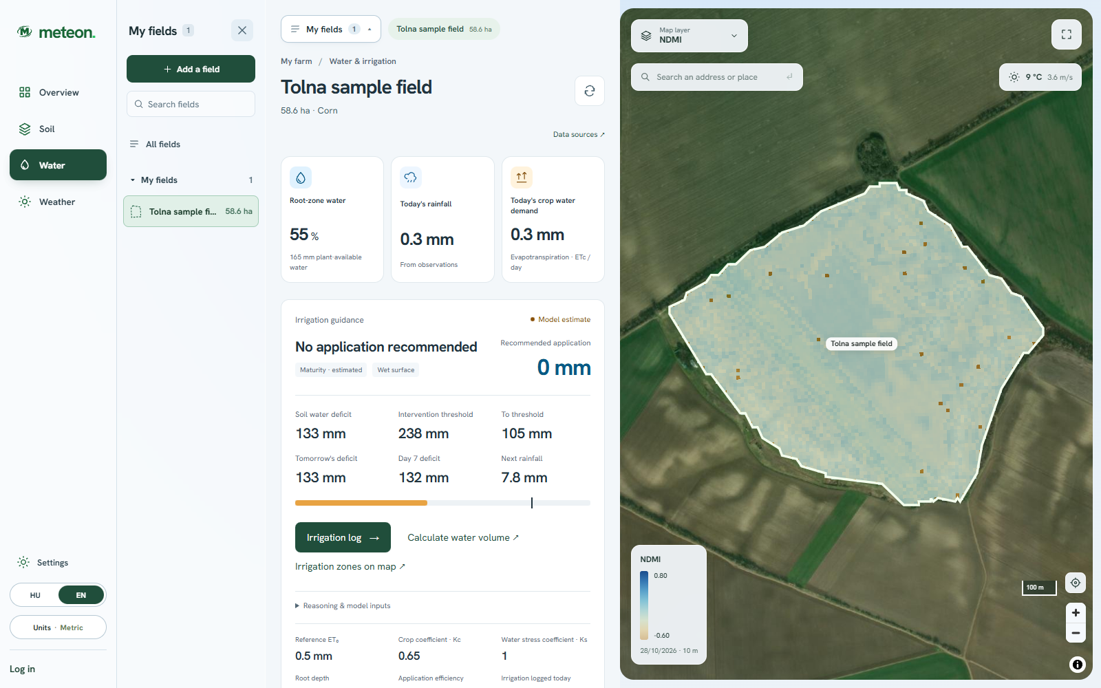 Enlarge screenshot
Temperature, rainfall, wind and humidity in switchable charts. Daily lows, frost indications and heat stress are close at hand.
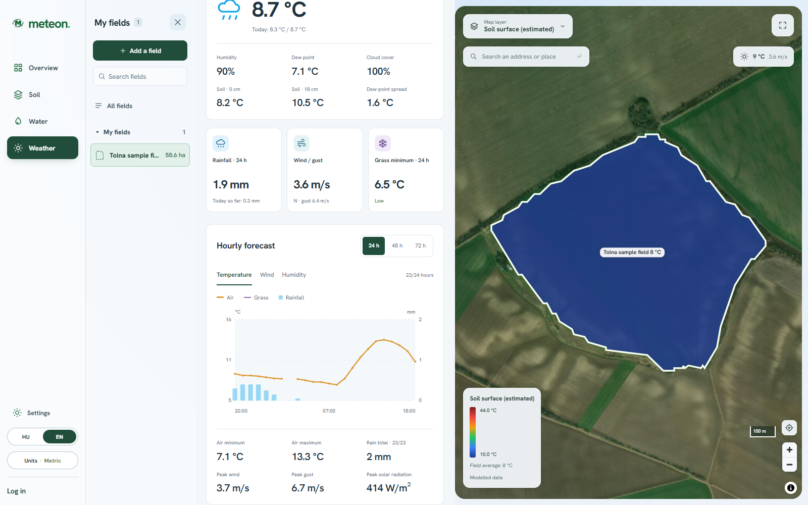 Enlarge screenshot
See the location alongside the numbers
Switch map layers, inspect the details, then return to the overview.
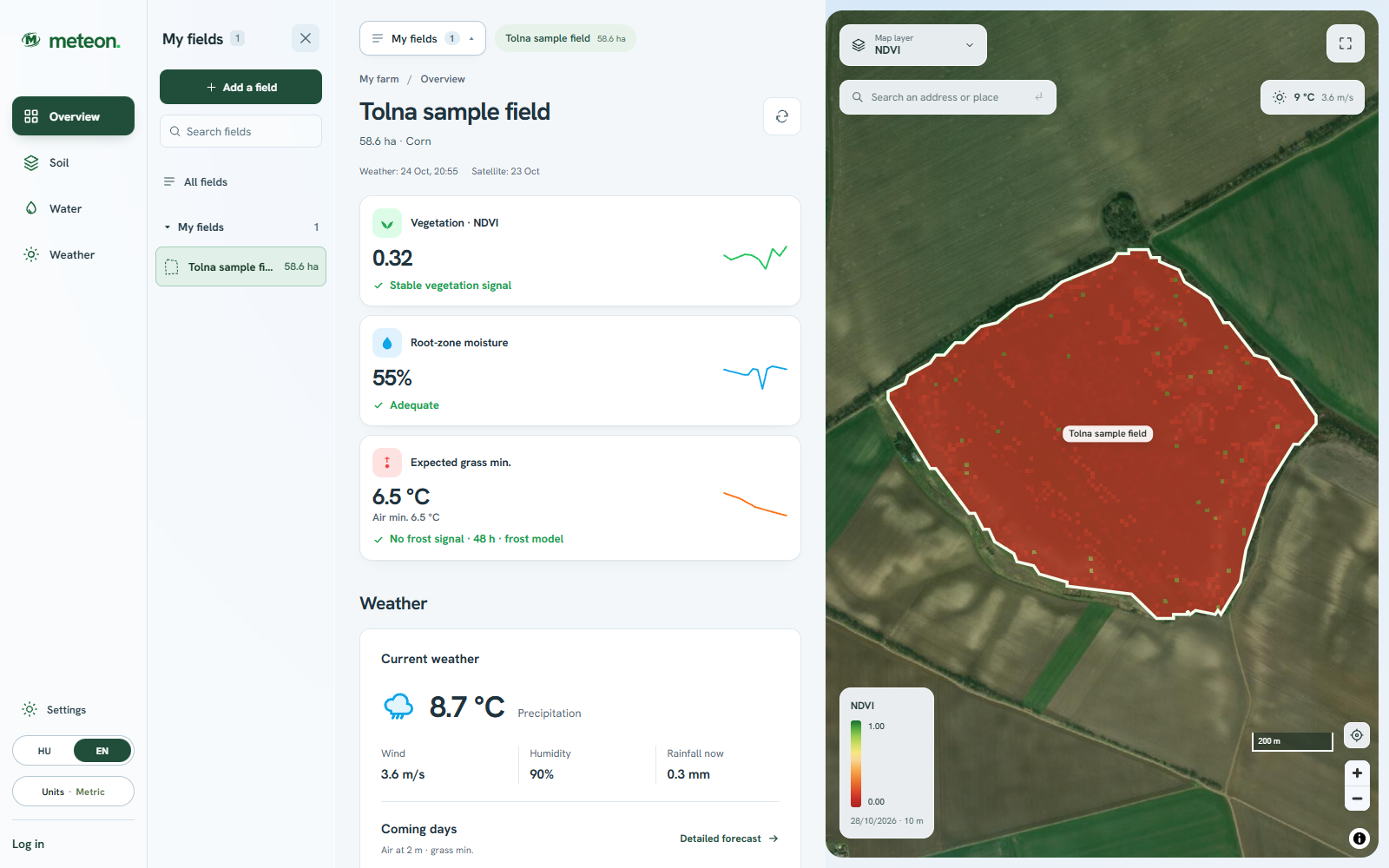 Enlarge screenshot
Overview and map
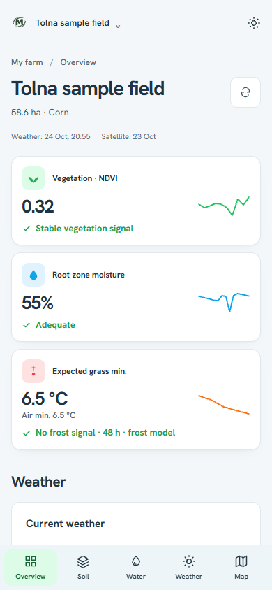
Follow NDVI and water-reserve trends alongside key field indicators. Open the detailed views directly from here.
 Enlarge screenshot
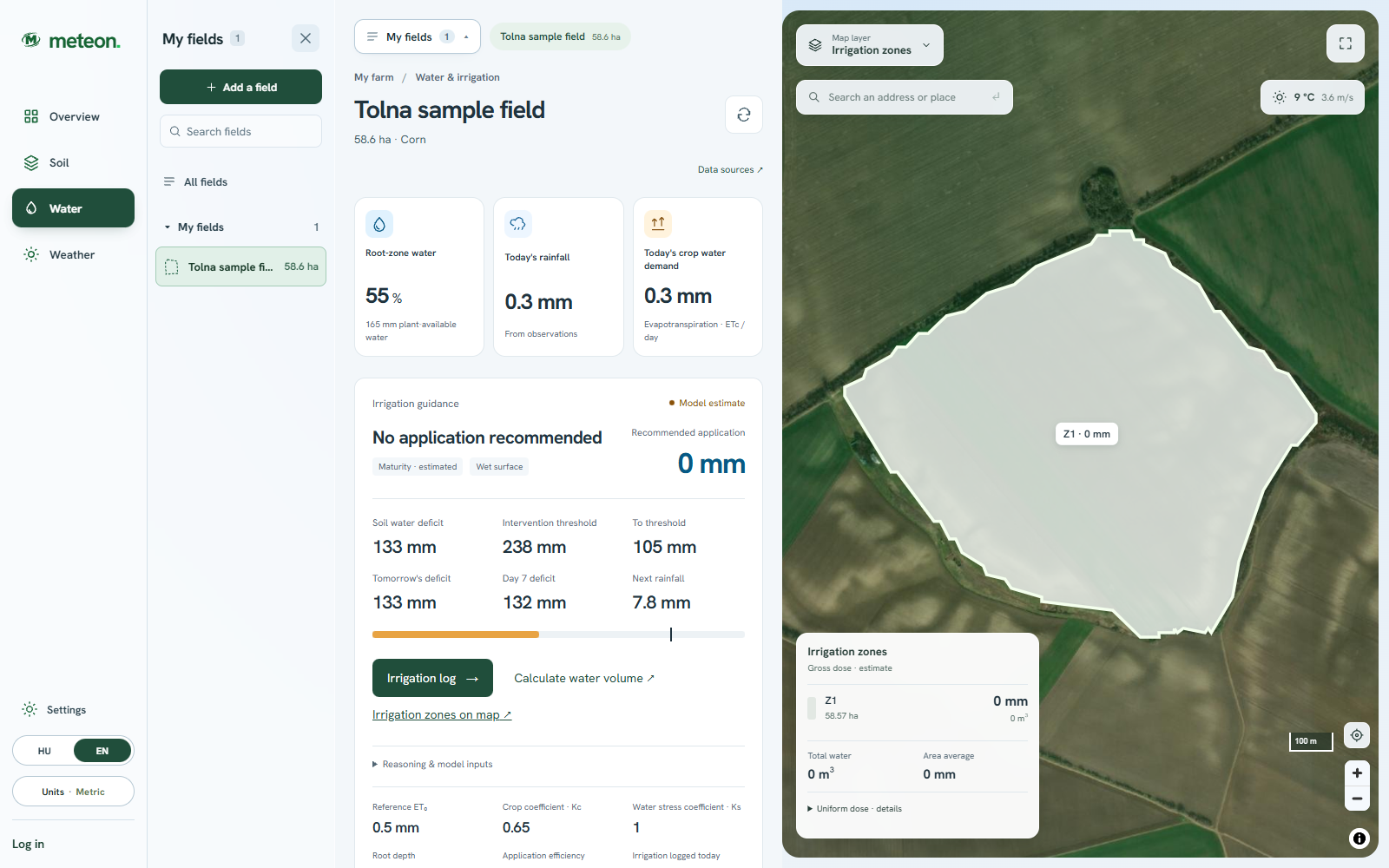
Irrigation zones
See estimated gross application, area and water volume for each zone. Select a zone for a closer look.
Without fresh spatial data, the field retains a uniform dose.
Out in the field too
Overview, Soil, Water and Weather are a tap away in the bottom navigation. Open the map in its own view too.
Start with your own field
No weather station is needed to try it. Create an account when you want to save your field.
Find it on the map, select a detected boundary or draw the outline.
Start with Overview, then open Soil, Water or Weather.
Set the crop for irrigation estimates, check fieldwork windows and record completed irrigation.
Measured accuracy
We compare the calculations with soil probes, lysimeters, evaporation towers and rain gauges at independent sites. The figures below are the results of those comparisons.
On a given field the difference can be smaller or larger. Soil and water-balance values are model estimates; your own measurements are labelled separately.
How Meteon calculatesReference sites: OVF drought monitoring, HungaroMet, ICOS, USDA-ARS (Bushland, Greeley), NOAA USCRN. Comparisons reflect the October 2026 state.
Estimates support planning alongside field experience. Check sources and dates in the detailed views.
Data sources and licencesNo. Meteon uses soil data, satellite observations and weather models. Mark your own field in the browser.
Available soil, satellite and weather data are linked to your boundary. Irrigation estimates also account for your selected crop and recorded watering.
No. Soil properties are model estimates, while satellite indicators come from observations. The analysis helps you understand field conditions and prepare for field checks; it does not replace targeted sampling or laboratory tests.
Soil profiles and weather are available without choosing a crop. Irrigation advice needs a recognised crop, because water demand and root depth depend on it.
Yes. It runs in the browser without installing anything, on phone and computer; the field can be marked by touch.
Missing values are shown as dashes. Without usable fresh spatial data for irrigation zones, the field retains a uniform dose.
The service is currently free, with every feature. An account is only needed to save the field.
Free · no registration
Explore regional rainfall deficits, convert rain to litres, or calculate irrigation water volume. Use the tools without signing up, in Brazil, Hungary and beyond.
Explore a more detailed national map of Hungary, with shortcuts to the Great Plain and Transdanubia. Choose Brazil or the world for international rainfall anomalies.
Open toolCalculator · mm, litres, m³Enter rainfall in millimetres and your area to see the total rainwater volume in litres and cubic metres immediately.
Open toolCalculator · volume and durationAlready know the water depth you plan to replace? Calculate the gross water volume and operating time for a flow rate you supply.
Open toolBrazil · Coffee · Microclimate
How can you interpret cold spots and coffee field risks? Explore guides written for Brazilian coffee farming, with sources and practical checks.
Understand air and plant temperatures, interpret cold spots in a Brazilian coffee field and combine field estimates with official frost warnings.
Read the guide ↗Learn how to interpret temperature differences within a field, distinguish model estimates from measurements and compare maps with local sensors.
Read the guide ↗Why coffee species, planting material, climate and growth stage matter when interpreting cold risk, water conditions and field microclimate.
Read the guide ↗
Your field comes next
Mark it on the map and explore its soil, water reserves and weather.
Currently free. An account is only needed to save your field.